The RECALL project is on the verge of unveiling a groundbreaking digital experience—an interactive map and catalogue that bring the rich history of Central Europe to life. Featuring 15 thematic topics, 40+ historical figures, and 300+ facts, the project will offer users a dynamic, engaging way to explore the region’s past. Through split-screen functionality, interactive layers, and immersive data visualization, this platform will allow you to dive deep into the stories of Central Europe’s historical landmarks, from Buda Castle to Ópusztaszer National Heritage Park. Stay tuned for the launch, and get ready to experience Central European history like never before!
The RECALL project’s catalogue and thematic map offer a rich exploration of Central European identity, presenting over 15 thematic topics, 40+ historical figures, and 300+ facts related to key memory sites across the region. This project brings history to life by connecting places, figures, and events in an interactive, visual format that aims to strengthen the shared identity of Central Europe.
Here’s an overview of the topics and how they enhance the understanding of the region’s complex history:
Thematic Topics and Key Highlights
The thematic topics cover a broad spectrum of Central European history, from early mythological origins to modern political developments. Each theme is designed to reflect the interconnectedness of the region’s cultural and political landscapes. For example:
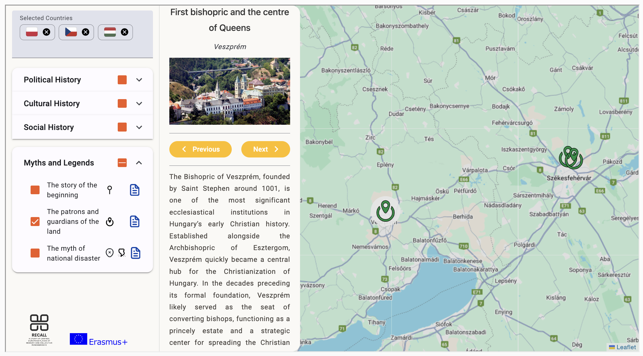
- 1. The Story of the Beginning: This theme delves into the myths of land-taking and early settlement stories, such as the Hungarian Land-taking Myth, represented by figures like the Turul, a mythological bird, and places like Ópusztaszer National Heritage Park.
- 3. The Myth of National Disaster: This explores historical periods of national catastrophe and resilience, such as battles lost and the long-term impacts on national consciousness.
- 4. Creation of Modern States (1918-1920): This theme focuses on the critical post-WWI period, where Central European countries emerged from the shadows of empires to form modern states, such as Poland, Hungary, and Czechoslovakia.
Figures and Facts: Bringing History to Life
The ReCall project’s visual map connects 40+ historical figures to specific places, providing a personal touch to historical events. For example:
- King Jagellonians and the Habsburgs: These figures are intertwined with sites such as Buda Castle, illustrating the political shifts and dynastic influences that shaped the region.
- The Verecke Pass Memorial: Marking the arrival of Hungarians to the Carpathian Basin, this site connects mythology with reality, representing a crucial moment in Hungarian national identity.
The project also includes 300+ facts, providing detailed contextual narratives for each site. Visitors to the interactive map will be able to engage with these sites through rich media, including photographs, texts, and links to further reading.
How Will the Catalogue and Map Enhance Central European Identity?
The ReCall project’s thematic map is more than just a historical reference—it is a tool for education and engagement. By visualizing the historical layers of Central Europe, the map allows users to explore:
- Interactive layers: Users can toggle between different historical periods, such as the medieval era, the 19th-century independence movements, and the post-WWI formation of new states. This feature makes it easy to understand how the past influences the present.
- Split-Screen comparisons: The split-screen functionality enables users to compare memory sites across different countries, highlighting the shared yet diverse experiences of Central Europe. For instance, users can simultaneously explore Ópusztaszer in Hungary and Spielberg Castle in Brno, drawing connections between the region’s myths and political developments.
What makes this project exciting?
- Bridging History and Technology: The project merges historical scholarship with modern technology, allowing users to engage with complex historical narratives in a visually intuitive way. It’s a perfect tool for educators, researchers, and history enthusiasts alike.
- Cross-Cultural understanding: The map fosters a deeper understanding of shared Central European identity, showing how different nations and cultures have contributed to the region’s history. By exploring these sites, users can gain insight into the common threads that bind Central European nations together, despite their diverse backgrounds.
Exciting points to watch
- Interactive exploration: Users will be able to „travel” through history by engaging with the map’s layers and multimedia content.
- Dynamic storytelling: The catalogue provides stories that go beyond the textbook, offering personal insights into figures like the Turul bird or King Jagellonians, making history feel alive.
- Educational value: The ReCall project is not only for historians but for anyone interested in understanding the roots of modern Central Europe, making it an excellent resource for schools and universities.
This project, by connecting historical events, places, and figures, will serve as a valuable resource in strengthening Central European identity and providing users with a deep, interactive experience of the region’s rich history. Stay tuned for the official launch of the map and explore how history has shaped Central Europe as we know it today!